Great walks in Hemel Hempstead showcased in new app launched for May’s National Walking Month
and live on Freeview channel 276
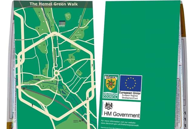
The council is launching a map to encourage walking and cyclings across neighbourhoods.
The Hemel Green Walk map will connect Hemel Hempstead and Apsley stations to the town and to show off some of the best places of the town this May.
Advertisement
Hide AdAdvertisement
Hide AdThe aim for the app, which will launch in May’s National Walking Month, is to make neighbourhoods more accessible, bringing walking and cycling connections to life and to integrate high quality green spaces into the public’s day-to-day lives.

Cllr Alan Anderson, portfolio holder for Planning and Infrastructure said: “Many people have been enjoying the mental and health benefits of walking during lockdown and we hope this trend will continue.”
He added: “This map aims to promote sustainable and active travel, as well as linking together some of the best places of Hemel such as Boxmoor, Jellicoe Water Gardens, the Old Town and Apsley.”

The Hemel Green Walk map can be looked at by using the LoyalFree app, which is free to download either on the App Store or Google Play.
Advertisement
Hide AdAdvertisement
Hide AdHard copies of the map can also collected from a number of venues including The Artichoke, Hemel Library, House of Elliot, Hive, The Old Town Hall, The Paper Mill, The Fishery Inn, Apsley Train Station, Hemel Hempstead Train Station, Liberty Tea Rooms and Community Hub, Tikis, Jennys, Story Café, Marlowes Shopping Centre, Riverside Shopping Centre and The Boxmoor Steakhouse.