UK weather: Storms set to batter Brits as Met Office issues multiple yellow warnings

and live on Freeview channel 276
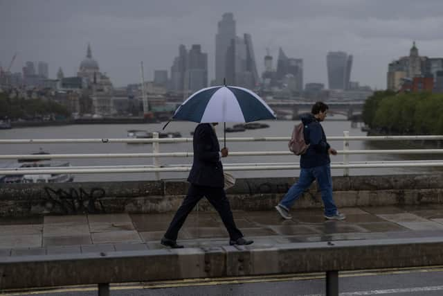
The Met Office has issued multiple weather warnings as thunderstorms and heavy rain are expected across the UK. The UK weather warnings come as Europe endures an extreme heatwave with recorded temperatures as high as 48C.
The forecaster has issued a thunderstorm warning for Saturday until 11pm which covers the whole of Scotland, northern England and Northern Ireland. There are also a number of alerts in place for heavy rain and strong winds.
Advertisement
Advertisement
The Met Office website states that thunderstorms and heavy showers are bringing some disruption. It adds: "There is a good chance driving conditions will be affected by spray, standing water and/or hail, leading to longer journey times by car and bus. Delays to train services are possible.
"Some flooding of a few homes and businesses is possible, leading to some damage to buildings or structures. Probably some damage to a few buildings and structures from lightning strikes."
The forecaster has also issued a weather warning for powerful winds across the south of England. The Met Office said Saturday is likely to be "an unseasonably windy day”, with the "possibility of damage caused to buildings."
It added:"Some delays to road, rail, air and ferry transport are likely.
Advertisement
Advertisement
"Some short term loss of power and other services is possible. It’s likely that some coastal routes, sea fronts and coastal communities will be affected by spray and/or large waves.
"Delays for high-sided vehicles on exposed routes and bridges likely. Some damage to trees or temporary structures such as marquees, tents & inflatables, could occur."
The strong wind warning has caused the cancellation of Saturday’s Goodwood Festival of Speed event for the “first time in its 30 year history”, said organisers. The event has been cancelled due to the risk to the public.

Met Office Chief Meteorologist, Andy Page, said: “This is an unusual time of year for such strong winds and, with many people on holiday or planning outdoor activities, they are likely to cause some disruption. In addition, heavy rain and thunderstorms could lead to standing water and spray on roads and consequently difficult driving conditions. Winds are expected to ease through the evening.
Advertisement
Advertisement
“Temperatures are expected to stay near average or rather cool over the coming days especially in the rain and wind.”
Regions and local authorities affected
Yellow wind warning
East Midlands
- Leicester
- Leicestershire
- Lincolnshire
- Northamptonshire
- Nottinghamshire
- Rutland
East of England
- Bedford
- Cambridgeshire
- Central Bedfordshire
- Essex
- Hertfordshire
- Luton
- Norfolk
- Peterborough
- Southend-on-Sea
- Suffolk
- Thurrock
London & South East England
- Bracknell Forest
- Brighton and Hove
- Buckinghamshire
- East Sussex
- Greater London
- Hampshire
- Isle of Wight
- Kent
- Medway
- Milton Keynes
- Oxfordshire
- Portsmouth
- Reading
- Slough
- Southampton
- Surrey
- West Berkshire
- West Sussex
- Windsor and Maidenhead
- Wokingham
South West England
- Bath and North East Somerset
- Bournemouth Christchurch and Poole
- Bristol
- Cornwall
- Devon
- Dorset
- Gloucestershire
- Isles of Scilly
- North Somerset
- Plymouth
- Somerset
- South Gloucestershire
- Swindon
- Torbay
- Wiltshire
Wales
- Blaenau Gwent
- Bridgend
- Caerphilly
- Cardiff
- Carmarthenshire
- Ceredigion
- Gwynedd
- Merthyr Tydfil
- Monmouthshire
- Neath Port Talbot
- Newport
- Pembrokeshire
- Powys
- Rhondda Cynon Taf
- Swansea
- Torfaen
- Vale of Glamorgan
West Midlands
- Herefordshire
- Warwickshire
- Worcestershire
Yellow storm warning
Central, Tayside & Fife
- Angus
- Clackmannanshire
- Dundee
- Falkirk
- Fife
- Perth and Kinross
- Stirling
Grampian
- Aberdeen
- Aberdeenshire
- Moray
Highlands & Eilean Siar
- Highland
North East England
- Durham
- Gateshead
- Newcastle upon Tyne
- North Tyneside
- Northumberland
- South Tyneside
- Sunderland
North West England
- Cumbria
- Lancashire
SW Scotland, Lothian Borders
- Dumfries and Galloway
- East Lothian
- Edinburgh
- Midlothian Council
- Scottish Borders
- West Lothian
Strathclyde
- Argyll and Bute
- East Ayrshire
- East Dunbartonshire
- East Renfrewshire
- Glasgow
- Inverclyde
- North Ayrshire
- North Lanarkshire
- Renfrewshire
- South Ayrshire
- South Lanarkshire
- West Dunbartonshire
Northern Ireland
- County Antrim
- County Armagh
- County Down
- County Fermanagh
- County Londonderry
- County Tyrone
UK weather forecast
Saturday, July 15
The start of the weekend sees blustery conditions, showers and a risk of some heavy rain and thunder at times. The winds will be strongest in the south and east of England where gusts are expected to widely reach 40 mph, with 50 to 55 mph in exposed places such as over hills and along the south coast.
The wind and rain will ease later in the evening.
Sunday, July 16
Sunday is expected to be less windy, but rain and showers will continue for the north of the UK with a risk of thunder, while further south will see a mix of sunny spells and showers.
Next week
There will be a mix of sunny spells and showers for most parts for the start of the working week. Some of the showers could be heavy with a risk of thunder. The unsettled theme to our weather looks set to continue through next week, although with more in the way of dry weather than recently for some parts.